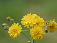
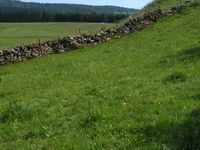
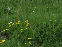
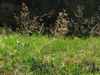
Dieses regelmässig beweidete Grasland besiedelt nährstoffreiche und gut drainierte Böden. Die Anpassung an die Tritt- und Weidebelastung ist an den Wuchsformen der dominanten Arten erkennbar. Sie bilden entweder unterirdische Ausläufer oder dem Boden anliegende Blattrosetten. Wo das Vieh die Stauden verschmäht, z.B. an Kotstellen oder weil die Pflanzen toxisch oder zu zäh sind, bilden sich auffallende Grasbüschel (Geilstellen), die der Weide im Vergleich zu Wiesen ein ungleichmässiges Aussehen geben. Durch wechselhaftes Bodenrelief wird dieses Bild oft noch verstärkt, und an steileren Partien bilden sich meist treppenartige, hangparallele Viehwege. Kammgrasweiden trifft man von der kollinen bis zur hochmontanen Stufe an.
Current distribution: Weighted sum (number of characteristic and frequent species) per hectare based on current observations. Reported characteristic species are given a weighting of 10, while others are counted without weighting. The habitat is considered to be present in a grid cell (5 x 5 km) if it contains at least one hectare with a minimum value of 11 points. Potential distribution: Weighted sum (number of characteristic and frequent species) per hectare based on species distribution models. The calculation strategy is the same as for current distribution, but maps derived from species distribution models are used instead of current observations. |
bold
Dominant species, influencing the appearance of the habitat
Character species
Less strictly linked to a specific habitat
National Priority | K: no national priority |
Need to take action | 0: mesures needed |
International responsibility | K: none |
IUCN status: Least concern
Additional information
IUCN criteria: --
CO | Collapsed |
CR | Critically Endangered |
EN | Endangered |
VU | Vulnerable |
NT | Near Threatened |
LC | Least Concern |
Regeneration class | 2: 5 to 10 years |